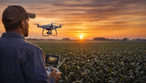
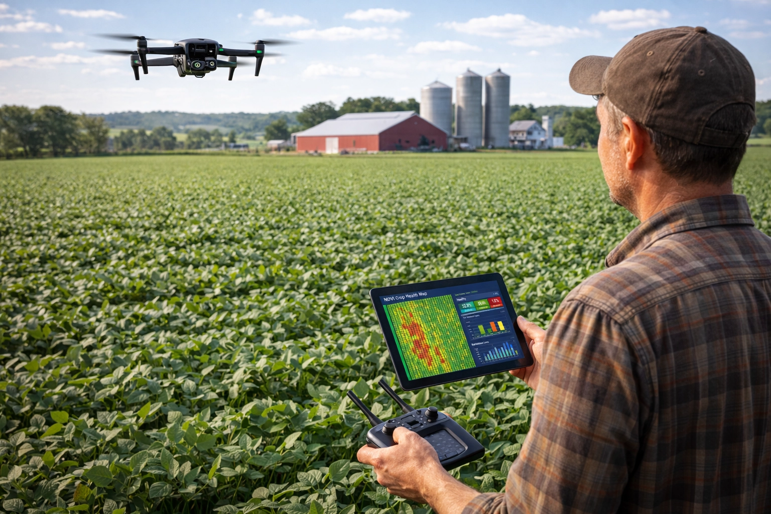
Just after sunrise in central Illinois, the corn fields appear calm from the gravel road. Rows stretch across hundreds of acres, their leaves still wet with morning dew. From the ground, the crop looks uniform and healthy.
But the farmer standing beside his pickup knows appearances can be misleading.
He removes a small drone from the truck bed, unfolds its arms, and launches it into the sky. Within seconds, the drone rises above the corn canopy and begins scanning the field.
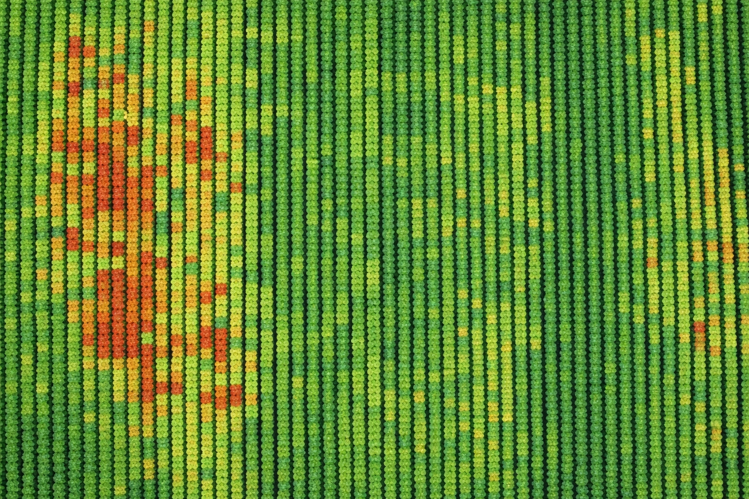
On the tablet in his hands, colored patches begin appearing across a digital map of the farm.
From the road the crop looked perfect.
From the air, it tells a different story.
Some parts of the field are already showing early nitrogen stress.
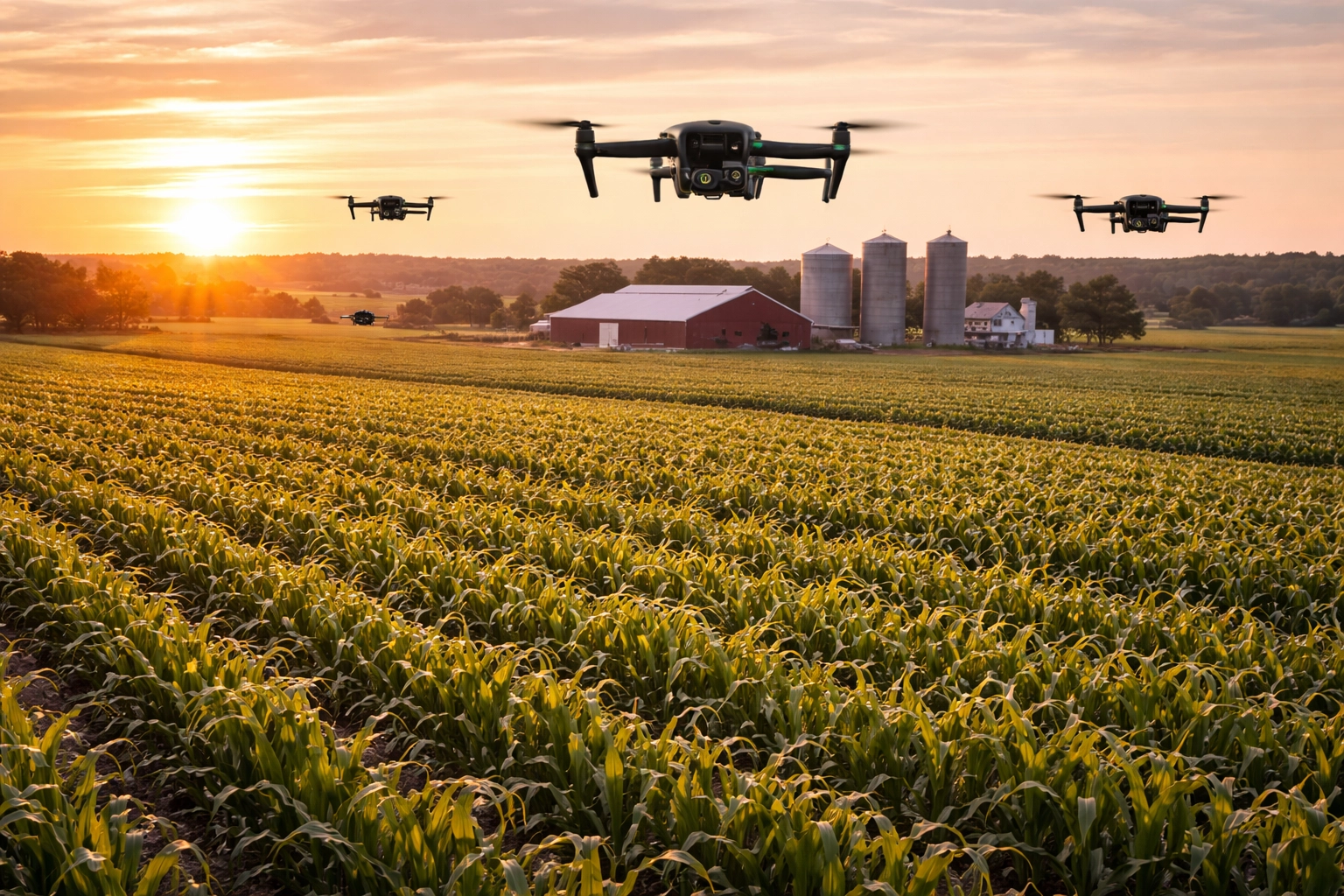
Across the United States in 2026, scenes like this are becoming increasingly common. Drones have quietly become one of the most practical tools farmers use to monitor crops and detect problems before they become visible from the ground.
What Farm Drones Actually Do in Crop Monitoring
At its core, crop monitoring with drones involves collecting aerial data about plant health.
Farm drones fly above fields capturing high-resolution images and sensor data that reveal subtle changes in crop conditions. These images help farmers identify issues early in the growing season.
The main functions of farm drones in crop monitoring include:
Aerial crop scouting
Drones can scan large fields quickly, capturing detailed images of crops that would otherwise require hours of walking through fields.
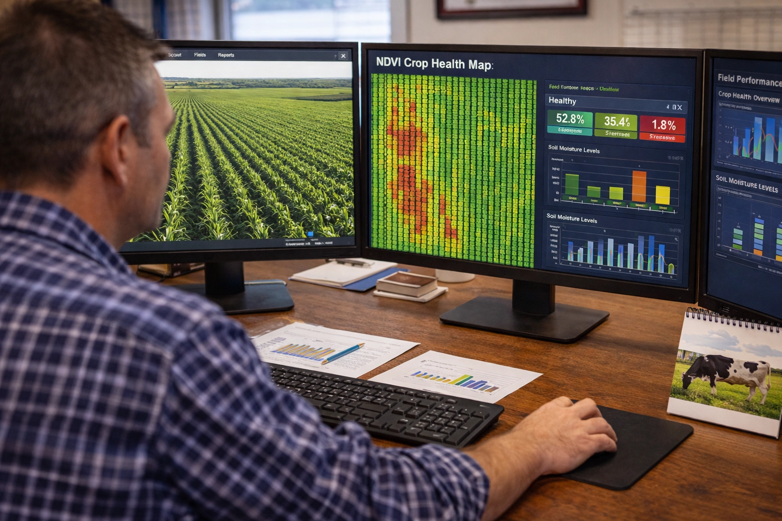
Plant health analysis
Multispectral cameras measure how plants reflect light. These measurements are used to calculate vegetation indices such as NDVI (Normalized Difference Vegetation Index), which indicate plant stress.
Pest and disease detection
Color changes detected by drone sensors often reveal fungal diseases or insect infestations before they spread across entire fields.
Irrigation monitoring
Drone imagery can identify dry areas within fields where irrigation systems are not delivering enough water.
Nutrient management
Variations in crop color and growth patterns often reveal nitrogen or nutrient deficiencies.
According to technology adoption research from the USDA Economic Research Service, remote sensing tools like drones are increasingly integrated into precision agriculture systems used by large crop farms in the United States.
https://www.ers.usda.gov/topics/farm-practices-management/precision-agriculture/
In simple terms, drones allow farmers to see what is happening across an entire field from above.
Must Read

AI and Automation Are Reshaping U.S. Agriculture in 2026
Artificial intelligence and automation are rapidly transforming American agriculture. From precision spraying to autonomous machinery and data-driven crop management, new technologies are helping farmers improve efficiency while facing rising labor shortages and production costs.
Why Early Detection Matters for Farmers
Crop problems rarely appear overnight. Stress from nutrient deficiencies, water shortages, or pests often develops gradually.
But if farmers detect these issues too late, yield losses may already be unavoidable.
Drone monitoring changes that timeline.
Instead of discovering crop problems weeks later during traditional field scouting, farmers can identify early stress signals and respond quickly.
That earlier response can include:
- adjusting fertilizer application
- modifying irrigation schedules
- applying targeted pest control
- identifying drainage issues
Even small timing improvements can influence final yields.
Data from crop monitoring systems often becomes part of broader farm decision-making systems used in precision agriculture.
The USDA National Agricultural Statistics Service (NASS) tracks the expansion of precision farming technologies across American agriculture through national surveys and technology reports.
https://www.nass.usda.gov
These reports show that data-driven crop monitoring is gradually becoming a normal part of modern farm management.
Comparing Crop Monitoring Methods
Farmers today have several options for monitoring crop health. Each method provides different levels of coverage and detail.
| Monitoring Method | Coverage Area | Detail Level | Cost |
|---|---|---|---|
| Field scouting | Small areas | Very detailed | Low |
| Satellite imagery | Entire regions | Moderate | Subscription |
| Drone monitoring | Individual fields | Very high | Equipment/service cost |
| Aircraft imaging | Large farms | High | Expensive |
This comparison highlights the unique role drones play in agriculture.
Satellites provide broad coverage but often lack the resolution needed to detect small field-level problems.
Traditional scouting offers detailed observations but is time-consuming.
Drones bridge the gap by delivering high-resolution imagery while still covering large sections of farmland quickly.
What the Comparison Reveals
No single monitoring method fully replaces the others.
Instead, modern farms increasingly combine technologies.
Satellite imagery may provide regular large-scale updates about crop conditions. When satellites identify potential stress areas, drones are often used to investigate those locations more closely.
Field scouting then confirms the exact cause of the problem.
In practice, drones act as a middle layer between satellite monitoring and traditional field scouting.
The Economics of Drone Crop Monitoring
The decision to use drones ultimately comes down to economics.
Agricultural drones equipped with advanced cameras can cost several thousand dollars. Software used to process drone imagery may also require subscription fees.
For large farms managing thousands of acres, these costs can often be justified by improved crop management.
Detecting a nutrient deficiency early in a 500-acre field may prevent yield losses worth far more than the cost of drone monitoring.
Financial research published by the Federal Reserve Bank of Kansas City notes that many farms are increasing investment in digital technologies and precision agriculture tools as part of broader farm modernization strategies.
https://www.kansascityfed.org/agriculture/
Some farms purchase drones directly, while others hire custom drone service providers that perform crop monitoring flights during key stages of the growing season.
Read Also

How Precision Agriculture Data Is Changing Farm Decisions in 2026
Precision agriculture tools are giving farmers deeper insights into soil conditions, crop health, and input efficiency. In 2026, data-driven farming is helping producers make smarter planting, fertilization, and irrigation decisions across U.S. agriculture.
Regulations Governing Agricultural Drone Use
Drone use in American agriculture also operates within federal aviation regulations.
Commercial drone operations must follow rules established by the Federal Aviation Administration (FAA) under Part 107 regulations. These rules require drone operators to obtain certification and follow guidelines related to altitude limits and airspace restrictions.
https://www.faa.gov/uas
These regulations were designed primarily for safety but have also shaped how agricultural drone services operate.
In recent years, policy discussions have also considered how emerging technologies like drones could affect farm productivity and environmental management.
Agricultural policy analysis published by the Congressional Budget Office notes that digital farming technologies may influence future agricultural productivity and input efficiency.
https://www.cbo.gov/topics/agriculture
Although drones themselves are not subsidized through federal farm programs, the research environment supporting agricultural technology continues to expand.
How Drones Are Changing Farm Decisions
The greatest impact of drones may not be the technology itself but the timing of decisions.
Traditional crop scouting often detected problems only after visible symptoms appeared in plants.
Drone monitoring allows farmers to detect stress earlier.
Earlier detection means earlier action.
For example, drone imagery might reveal:
- early nitrogen deficiency
- uneven irrigation coverage
- developing fungal disease
- localized insect infestations
Addressing these issues quickly can prevent larger yield losses later in the season.
For farms operating with narrow profit margins, these small improvements in timing can significantly affect financial outcomes.
The Broader Impact on U.S. Agriculture
Drone technology represents one part of a larger transformation in American agriculture.
Precision farming systems increasingly combine data from satellites, drones, soil sensors, and machine learning models.
These tools allow farmers to manage fields more precisely while potentially reducing input waste.
Improved crop monitoring may also support environmental goals by helping farmers apply fertilizers and pesticides only where needed.
But the benefits may not be distributed evenly.
Large farms typically adopt new technologies first because they have greater access to capital. Smaller farms often adopt later as equipment costs decline or service providers expand.
Despite these differences, the trend toward digital crop monitoring appears likely to continue.
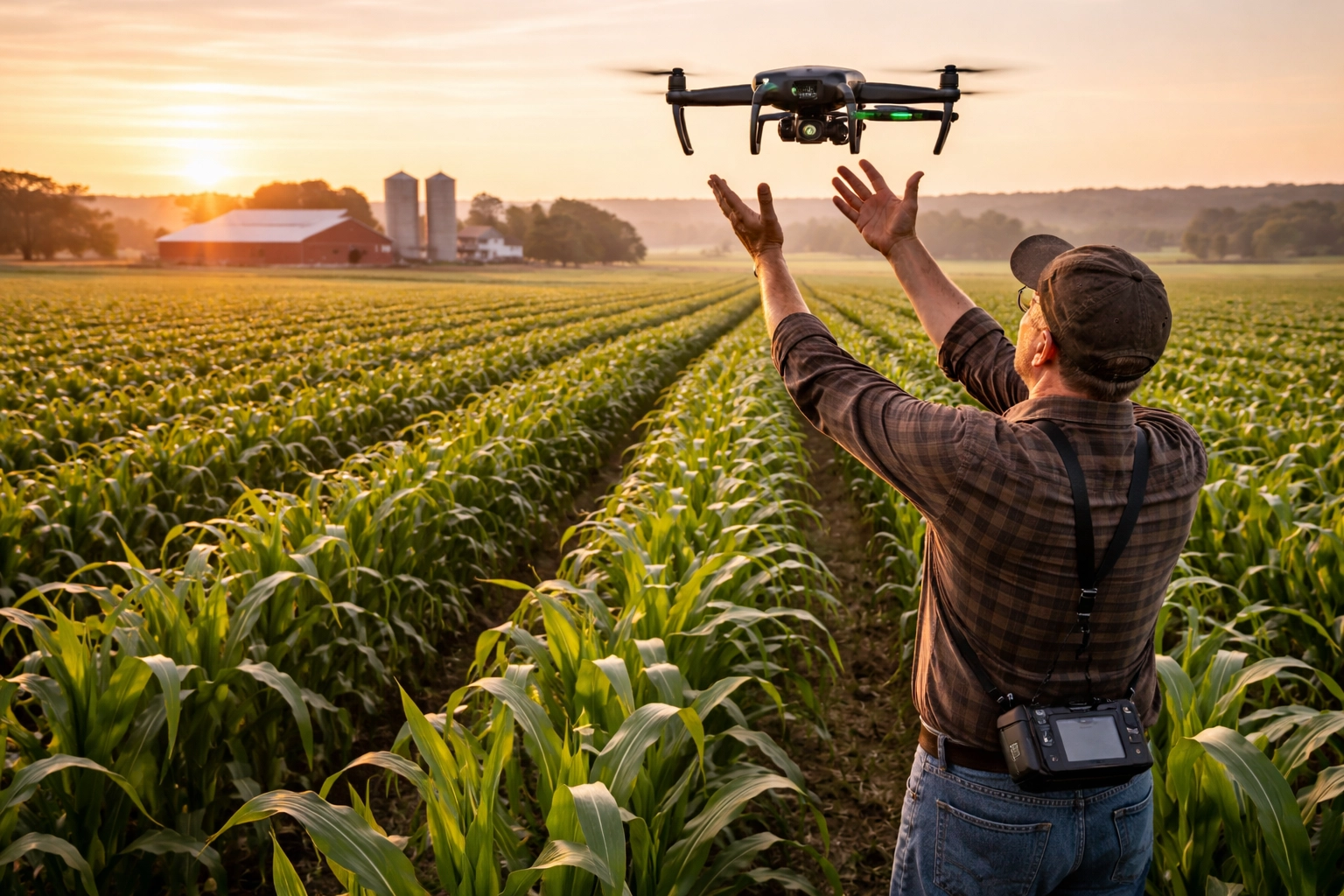
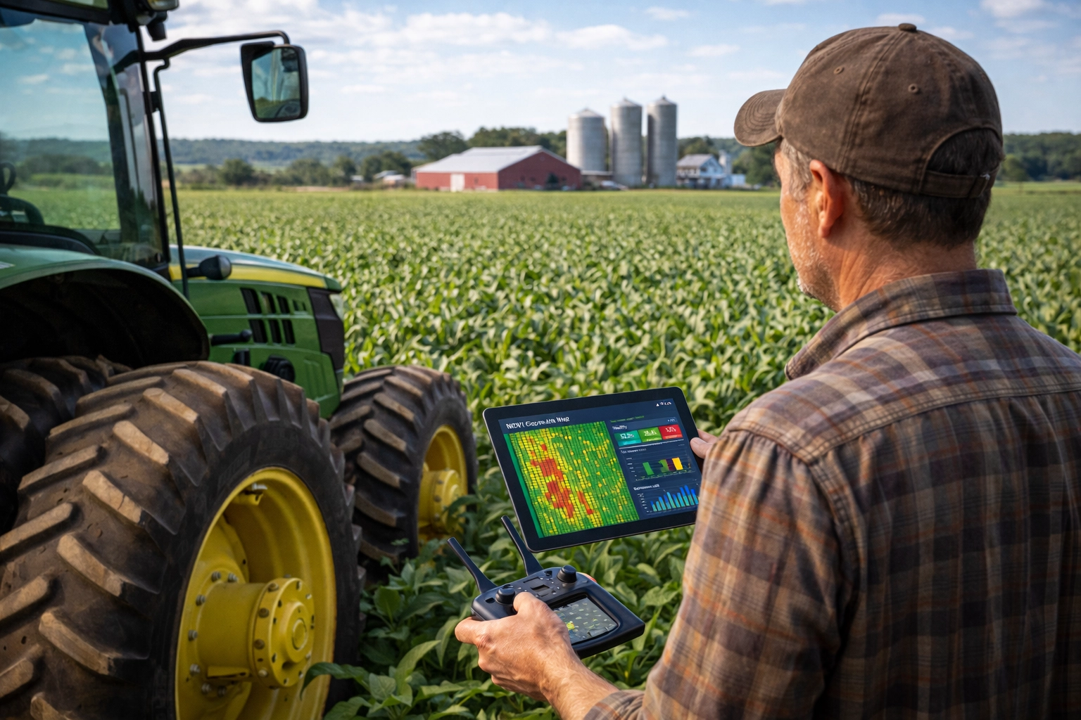
Back Above the Corn Field
The drone circles once more before returning to the farmer’s outstretched hand.
On the screen, the field map shows several small zones where crop stress is beginning to appear.
From the road, the field still looks perfect.
But the farmer now knows exactly where the problems are.
Without the drone, those warning signs might not have appeared until weeks later.
In modern agriculture, that small difference in timing can make the difference between an average harvest and a profitable one.

Written by Janardan Tharkar – an agriculture content researcher and blogging professional with practical experience in farming education, digital publishing, and SEO content optimization. Janardan focuses on modern U.S. agriculture trends, smart farming technologies, irrigation systems, crop development, organic farming practices, and farmer-support programs to create helpful, practical, and trustworthy content for American readers.